With a twinge of sadness, because we had enjoyed our stay at
Glen Helen so much, we left the West Macs.
But it was time to tackle the next stage of our journey. There are two ways to drive to Watarrka (Kings Canyon)– the nice, safe but much longer
(for us) sealed road, or there was the Mereenie Loop:
“The Mereenie
Loop provides for an alternative scenic route from Alice Springs to
Watarrka (Kings Caynon) and Uluru (Ayers Rock) via the Western Macs. ... The condition of Mereenie Loop Road surface is dirt and unsealed is seasonal with
flash flooding with access sometimes limited due to weather and traffic.”
After all we had a full set of brand new tyres and we knew
there was a regular flow of traffic on the road – so we took the Mereenie
Loop. Actually it wasn’t that bad. There was at least 150k of dirt, but we
passed the graders on our way through so apart from a few corrugated sections
(and we had seen worse in the gulf country) it was not a bad drive and the
scenery was beautiful. You do need a
permit to drive on this road as it goes through aboriginal land and they ask
that you do not take pictures which we didn’t.
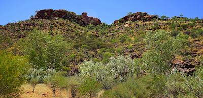
At the end of the loop the road is again sealed and you can begin to see
why so many travelers come here with early views of the Gorge Gill Range
(including Kings Canyon) tempting these travelers out of the car cameras at the
ready.
 |
| Yep still the view from the road – actually the passenger seat window with the telephoto lens balanced on the sill. Worked well didn’t it. |
There are only three main walks available and most people
come to do the outer rim walk. David and
I had done it in 2004 so knew what we were up for. This walk is closed after 9am on days greater
than 36 – it is stony and there is not a hint of shade for most of the
walk. The rocks intensify the heat which
is why they close it so early. Still in
spite of the forecast of 39 for that day we planned to be up early and underway
hopefully by 7. But then came the
wind. All night it howled a gale which
continued that morning. Neither David or
I wanted to risk taking the kids up there in the force of that wind. Whilst they were unlikely to be blown off the
cliff, we could see them diving after their new hat. We also thought that it wouldn’t be a
pleasant experience so we limited ourselves to the two smaller walks and ended
up at the campground pool in the afternoon for a considerable period of time.
Kathleen Springs Walk
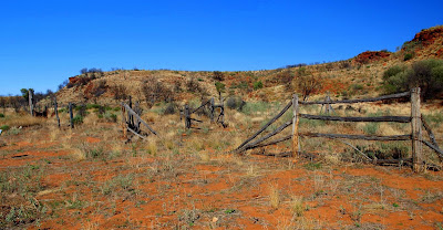
There are signs along the path that tell the stories of Aboriginal Culture and the recent use by the cattle industry with the ruined stockyards alongside the walk.
The walk leads to a spring fed waterhole at the head of Kathleen Gorge. The waterhole holds special significance for the local Aboriginal people and is important for wildlife, so swimming is not permitted. The national park brochure says that this is a cool moist place to sit and enjoy the area’s tranquility – but David used the time to photograph some of the many dragonflies also enjoying the waterhole. I just used my time photographing my boys.
Kings Creek
Whilst the rim walk traverses all around the creek area from up high, there is a short walk that leads up the creek and used to take you all the way to where the water falls over the cliffs. However when we arrived we found out that there had been a very large rockslide just over a year ago so half the track was now closed. It was still a pleasant but much shorter walk now.
Sunsets over Watarrka
We stayed at the resort camping ground – both for its pool
(did I mention the 39 degree temperatures) but also because the resort is
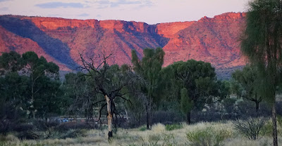
beautifully positioned for sunsets over the ranges. As we were there two nights we used two
different viewing areas to take photographs from. Here are some of the results.
The wind howled all night again, so when it was time to
leave we were quite glad to move on.
Beautiful and rugged though this place is. We had found it a more difficult place to
camp and definitely to sleep.


No comments:
Post a Comment